Supported Formats
| Type | Supported Input Formats | Default Output Format | Supported Convertible Output Formats |
|---|---|---|---|
| Point | YOLO | YOLO | YOLO Esri Shapefile Image mask |
| Horizontal Bounding Box | YOLO VOC COCO | YOLO | YOLO VOC COCO Esri Shapefile Image mask |
| Oriented Bounding Box | DOTA YOLO OBB | DOTA | DOTA YOLO OBB Esri Shapefile Image mask |
| Polygon | Labelme JSON COCO YOLO | Labelme JSON | COCO YOLO Esri Shapefile Image mask |
| Polyline | Labelme JSON | Labelme JSON | Esri Shapefile Image mask |
Core Features
Multiple Annotation Modes
Supports multiple annotation types including rectangular bounding boxes (HBB), oriented bounding boxes (OBB), center point annotations, polygon annotations, and polyline annotations. Supports export to COCO, VOC, YOLO, Mask and Esri Shapefile formats.
Remote Sensing Data Support
Supports multi-band (greater than 3) remote sensing data input in formats such as tif with geographic coordinates. Configurable band combination display settings.
Sub-image Extraction
Convenient sub-image cropping with automatic annotation coordinate adjustment and arbitrary size settings. Remote sensing image extraction maintains correct coordinate information.
Quick Path Logging
Quickly save questionable image paths to log files with Enter key for convenient secondary review
One-Click Display
One-click show or hide annotations to avoid interference with image viewing, facilitating annotation in complex dense areas. You can also display only the currently edited target and hide other targets.
OBB Rotation Annotation
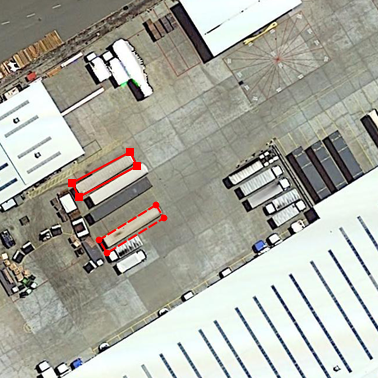
Support for oriented bounding box annotation at arbitrary angles, suitable for remote sensing images, text detection, and other scenarios. Left mouse button edits length and width dimensions, right mouse button controls rotation angle for convenient operation.
Video Tutorials
Annotation Examples
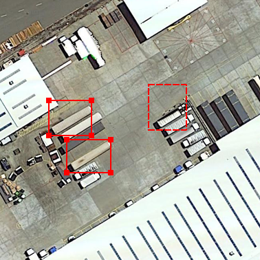
Horizontal Bounding Box (HBB)

Traditional horizontal rectangular bounding box annotation, suitable for most object detection tasks. Supports quick drawing and precise adjustments.
Oriented Bounding Box (OBB)

Supports bounding box annotation with arbitrary angle rotation, especially suitable for remote sensing images, text detection and other scenarios.
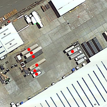
Center Point Annotation (Point)

Precise center point localization annotation, suitable for object center positioning, small object detection and other tasks.
